Regions of Ontario and farming: Lesson plan and activity
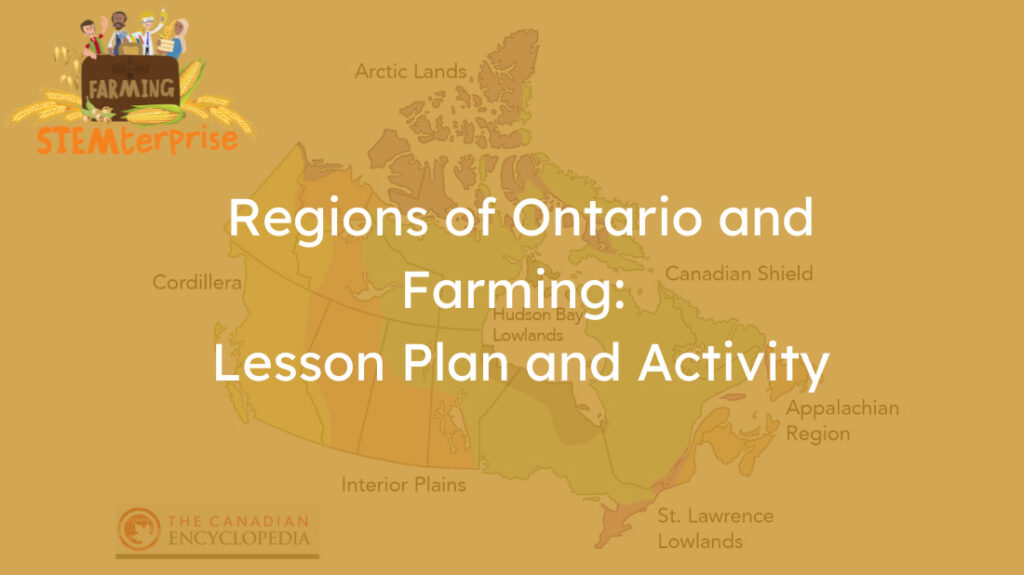
In this lesson we will look at Ontario’s regions and their suitability for agriculture. Canada is a large country with seven physiographic regions. Ontario includes three of them: the Hudson Bay Lowlands, Canadian Shield, and the Great Lakes-St. Lawrence Lowlands. Some of the seven physiographic regions, including the ones in Ontario, are not suitable for agriculture. Farmers have to do a lot with the soil available to them.
Grade 3 Lesson Plan
Note: The following content has been written so that it could easily be used in your teaching slides.
Curriculum relevance:
Social Studies – Living and Working in Ontario
B1.1 Describe major connections between features of the natural environment of a region and the type of land use
B1.3 Identify and describe … land use … using mapping and globe skills
B3 Describe major landform regions and types of land use in Ontario
B3.3 Identify the major landform regions in Ontario and describe the major characteristics that make each distinct
Soils in the Environment
- E1.1 Assess the importance of soils for society and the environment
- E2.1 Identify the living and non-living components of soil, and describe the characteristics of healthy soil
- E2.3 Examine different types of soils found in Ontario, and describe how different soils are suited to growing different types of food, including crops
- E2.6 Describe the process of composting, and explain some benefits of composting
Agriculture/Agri-Food Themes
- Soil literally impacts every bite we take.
- Soil health is a crucial component of agriculture.
Preparing for the lesson: This lesson has been extracted and expanded on from STEMterprise: Stage 4, Lesson 2 (Soil Types in Ontario and Regions). You can download the editable slide deck and lesson plan at https://goodineverygrain.ca/ontario-farming-stemterprise/
Lesson plan content
Minds ON!
Have a little fun, if you don’t mind puns!
- What is a soil’s favourite candy? Answer: Gummy worms
- What is soil’s favourite form of transportation? Answer: A dirt bike
- What did the soil say to the plant? Answer: I’m rooting for you
- Why does soil never lie? Answer: Because the truth isn’t hard to dig up.
After discussing these riddles with students ask – predict the relationship between soil, agriculture and regions of Ontario?
Lesson content:
Reminder: Download the associated lesson slides here.
1. Discuss. Soil is not the same everywhere—it is special to the place where it formed. There are different types of soil. That means the same crops cannot be grown everywhere; for example, we cannot grow pineapples in Ontario!
Brainstorm: Why farmers must understand soil, soil health, and what their crops require to thrive?
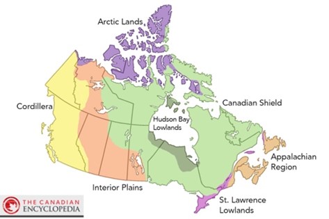
2. Show the map of the 7 physiographic regions of Canada— physiographic means physical geography. They are the Canadian Arctic, the Western Cordillera, the Interior Plains, Canadian Shield, the Hudson Bay Lowlands, the St. Lawrence Lowlands, and the Appalachian Region.
As you can see, most of Ontario is within the Canadian Shield, a huge region that covers 5 million square kilometers, or 48% of Canada.
Crops grow better in some regions of Ontario than others. Let’s learn about the Regions of Ontario and think about where our food is grown.
Show a map of Canada and locate Ontario on the map.
Learn more at: https://www.thecanadianencyclopedia.ca/en/article/physiographic-regions
3. Three of Canada’s seven regions are in Ontario. They include: Canadian Shield, Hudson Bay Lowlands and Great Lakes-St. Lawrence Lowlands
Consider showing the map found on The Canadian Encyclopedia website:
4. The Canadian Shield is also called the North American Craton (a craton is a large stable block of the Earth’s crust that makes up the nucleus of a continent). It covers most of North America, from Mexico to Greenland. It consists of rocks that are at least 1 billion years old and, except for the Canadian Shield, are buried deep and covered by soil. The Shield isn’t just rock—it has lots of minerals and is covered by coniferous forests.
Ontario was once covered by ice. As it receded (as recently as 11,000 years ago), it carved out many lakes exposed the rock of the Shield.
- Watch this! Canadian Shield in Ontario (4:33)
Farming can be hard within the shield due to the amount of rock, poorer soil quality and lack of nutrients. It also has a cold climate. But there are farming areas in Ontario, within the Canadian Shield that grow a lot of grains for food (like the Ottawa Valley region and Temiskaming Shores).
Canadian Shield has pockets of areas (Temiskaming Shores region) that are provincially renowned for growing the best oats for oat processing into cereals and granola bars.
Learn more at: https://www.thecanadianencyclopedia.ca/en/article/shield
5. The Hudson Bay Lowlands
- Watch this! Hudson Bay Lowlands Tour (5:53)
The Hudson Bay Lowlands is a sedimentary basin; 40% of it is in the middle of the Canadian Shield and the rest is under the water of Hudson Bay and James Bay. Much of the surface is covered by muskeg and peat.
Farming is very difficult here because the region’s landscape is not suited to growing most crops.
Discuss – What else might make it difficult to farm in this region? (Hint: short growing season, low population, limited roads, etc.).
Learn more at: https://www.thecanadianencyclopedia.ca/en/article/geography-of-ontario
6. The soil of the Great Lakes-St. Lawrence Lowlands is underlain by a layer of clay and was shaped by the movement of water as the glaciers retreated.
- Watch this! St. Lawrence Lowlands Tour (3:30)
Agriculture is the dominant land use here. Grain production, Dairy farming and production of livestock, potatoes, field vegetables, orchards can all be found in this region!
Learn more at: https://www.thecanadianencyclopedia.ca/en/article/st-lawrence-lowland
Vocabulary:
agriculture – the science or practice of farming
crop – a plant that is grown for food
marsh – an area of low-lying land which is flooded in wet seasons or high tide
peat – a brown deposit resembling soil
permafrost – a subsurface layer of soil that remains frozen all year
region – an area or part of a country what has definable characteristics
sparce – thinly, dispersed or scattered
loam soil – a type of soil that is a mixture of sand, silt and clay which is high in nutrients.
Action!
What’s in your lunchbox? What region did it grow?
Learning goal:
- Students will learn the characteristics of the regions that might allow crops to grow.
- Students will make the connection from the food in their lunchboxes to the plants they come from.
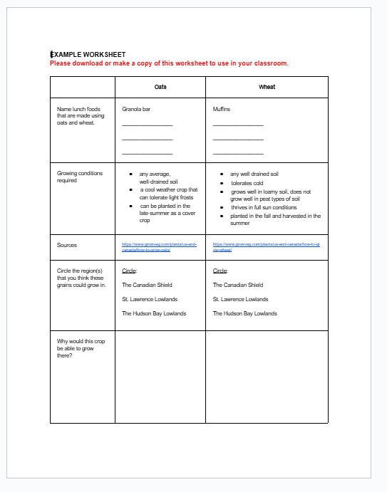
Step 1: Lunch scavenger hunt. With students working in partners, challenge student to check their lunchboxes and find (or brainstorm) lunch foods that use these Ontario-grown grains?
Oats, Wheat
Step 2: Can students predict the regions where oats, soybeans and wheat could be farmed? Teachers could use our Example Worksheet to create a GoogleForm or activity sheet. This could also be used as a whole-class activity.
Wrap-up:
Exit ticket: Which area of Ontario would you choose to live in if you were a farmer and why?
Extension Videos:
